I have a shapefile with geographical polygon data (downloaded here: https://www.geoboundaries.org/downloadCGAZ.html)
I want to write the data into an SQL database so that I can intersect it with longitude / latitude data. I already tried the following:
library(sf)
# Read the shapefile into R
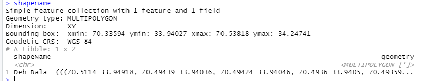
shapename <- read_sf('.../DownloadsgeoBoundariesCGAZ_ADM2/geoBoundariesCGAZ_ADM2.shp')
# Set up connection to SQL database
con = dbConnect(odbc(),
Driver = 'Driver',
Server = 'Server',
UID = 'Test'_UID,
scheme = 'dbo',
PWD = 'Test_PWD'
encoding = 'latin1')
# Write data into database
dbWriteTable(con, name = 'Test.dbo.Geo_Polygons', value = shapename)
Unfortunately, this will write the field geometry into the database as a varchar(max). However, in order to intersect it with longitudes / latitudes, I think it should be of type geography with CRS WGS84.
How do I manage to write the geometry data in the correct format into the SQL database?