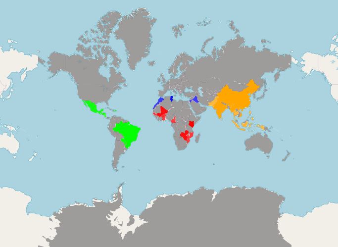
Folks, I have a problem. My map has an unusual gray shadow. I use shapefiles
countries <- readOGR(".","ne_50m_admin_0_countries")
or geojson
url <- "https://raw.githubusercontent.com/datasets/geo-countries/master/data/countries.geojson"
countries <- geojson_read(url, what = "sp")
Does not matter, both have the same error.
I had this issue before but did not find a sustainable solution and my search did not help, that is why I am here.
How do I color?
# Color palette
colorFactors = colorFactor(c('red', 'orange', 'blue', 'green'),
                      domain = dfs_pg$Region)

# Create a map
leaflet(dfs_pg) %>%
addProviderTiles(providers$OpenStreetMap) %>%
addPolygons(stroke = FALSE,
          fillOpacity = 0.75,
          color = colorFactors(dfs_pg$Region), weight = 1)
There are multiple NAs and I tried to omit them - did not work for me. I want to keep NAs the same color as the original provider without this shadow.
I merge my csv and geojson into a spatial dataframe.
The same problem is for ANY provider.
Really appreciate your help! Thanks!
