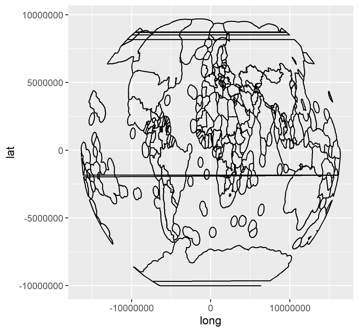
Im trying to plot world eezs as a Winkel Tripel projection, however Im having issues with lines of the eezs extrapolating across the countries. Whats the best way to remedy this issue? The code is below.
The shapefile of the Exclusice Economic Zone of countries EEZ boundaries was downloaded from http://www.marineregions.org . The shapefile was converted in SpatialPolygonsDataFrame using rgdal:
layer = "EEZ_land_v2_201410.shp"
path  = "C:\\shapefile\\EEZ_land_union_v2_201410"

library(tools)
library(rgdal)
library(ggplot2)
eez = readOGR(dsn = path, layer=file_path_sans_ext(layer))
test = spTransform(eez, CRS("+proj=wintri"))
test = fortify(test)
ggplot()+ geom_path(data=test, aes(x=long,y=lat, group=group))
