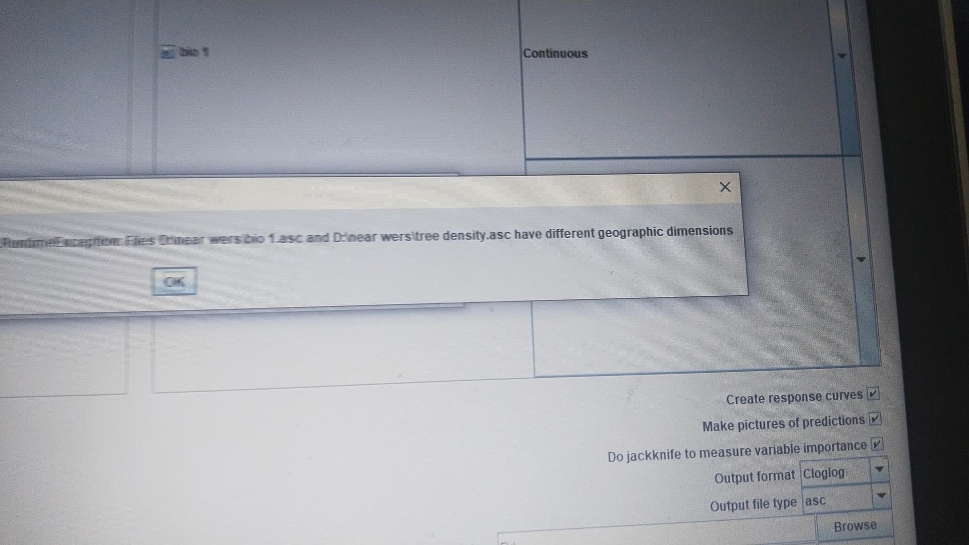
I wanted to do an sdm in maxent using some potential layers and one among them is tree density, after masking bioclim and tree density layers in qgis, I uploaded in maxent ,but then there is an error (attached as screenshot) saying "different geographic dimensions". I tried resampling with qgis and R. It is not working, can anyone resolve? Thanks in advance
I am herewith attaching one bioclim layer, tree density layers and the original shp file.