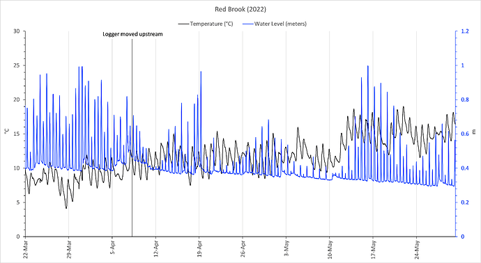
I have water height data of a local stream over time. The issue is that this stream is affected by the tides. I am wanting to remove the daily tide peaks and just get that minimum water height base line (blue) which hovers around 0.3 meters (right y-axis). Any suggestions would be appreciated!
Can you please post a sample of your data (see here) and any code that you've used to generate the plots?
This topic was automatically closed 21 days after the last reply. New replies are no longer allowed.
If you have a query related to it or one of the replies, start a new topic and refer back with a link.
