I am working with the R programming language.
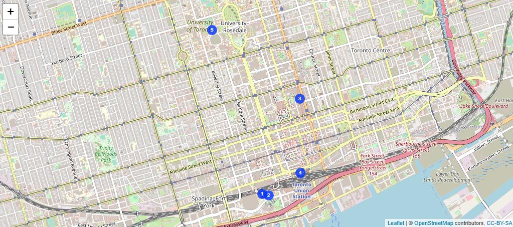
Using the "leaflet" library, I made the following map for these 5 cities:
library(dplyr)
library(leaflet)

map_data <- data.frame("Lat" = c(43.6426, 43.6424, 43.6544, 43.6452, 43.6629), "Long" = c(-79.3871, -79.3860, -79.3807, -79.3806,-79.3957 ), type = c(1,2,3,4,5))

map_data$type = as.factor(map_data$type)


leaflet(map_data) %>%
    addTiles() %>% addCircleMarkers(stroke = FALSE, label = ~type,fillOpacity = 0.8, labelOptions = labelOptions(direction = "center",style = list('color' = "white"),noHide = TRUE, offset=c(0,0), fill = TRUE, opacity = 1, weight = 10, textOnly = TRUE))
On this above map that I have created, I would now like to "connect" all these "points" (i.e. cities) on the map (in a circular route) based on their "number" (e.g. connect 1 with 2, 2 with 3, 3 with 4, 4 with 5, 5 with 1), and output the "total distance" of the route. I found a previous post that shows how to do this: How to show path and distance on map with leaflet, shiny apps?
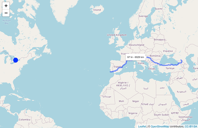
I tried to adapt the code from this post to suit my question:
library(osrm)

route = osrmRoute(c(-79.3871, -79.3860, -79.3807, -79.3806,-79.3957 ), c(43.6426, 43.6424, 43.6544, 43.6452, 43.6629),  overview = 'full')


route_summary = osrmRoute(c(-79.3871, -79.3860, -79.3807, -79.3806,-79.3957 ), c(43.6426, 43.6424, 43.6544, 43.6452, 43.6629), overview = FALSE)

leaflet() %>% addTiles() %>%
    addCircleMarkers(c(-79.3871, -79.3860, -79.3807, -79.3806,-79.3957 ), c(43.6426, 43.6424, 43.6544, 43.6452, 43.6629), stroke = FALSE, label = ~type,fillOpacity = 0.8,
                     labelOptions = labelOptions(direction = "center",style = list('color' = "white"),noHide = TRUE, offset=c(0,0), fill = TRUE, opacity = 1, weight = 10, textOnly = TRUE)) %>%
    addPolylines(route$lon,route$lat,
                 label = paste(round(route_summary[1]/60), 'hr - ', round(route_summary[2]), 'km'),
                 labelOptions = labelOptions(noHide = TRUE))
But this returns the following error:
Error in UseMethod("metaData") :
  no applicable method for 'metaData' applied to an object of class "NULL"
Can someone please show me how to fix this problem?
I would like to do this using "leaflet" and not using "rshiny".
Thanks!
Note: I am starting to think that problem might be that the "osrmRoute()" function might not be able to work for more than 2 points?

