Arizona Indigenous Tribal Water Rights
Authors: Greg Chism
GitHub
Website
LinkedIn
Table
Full Description:
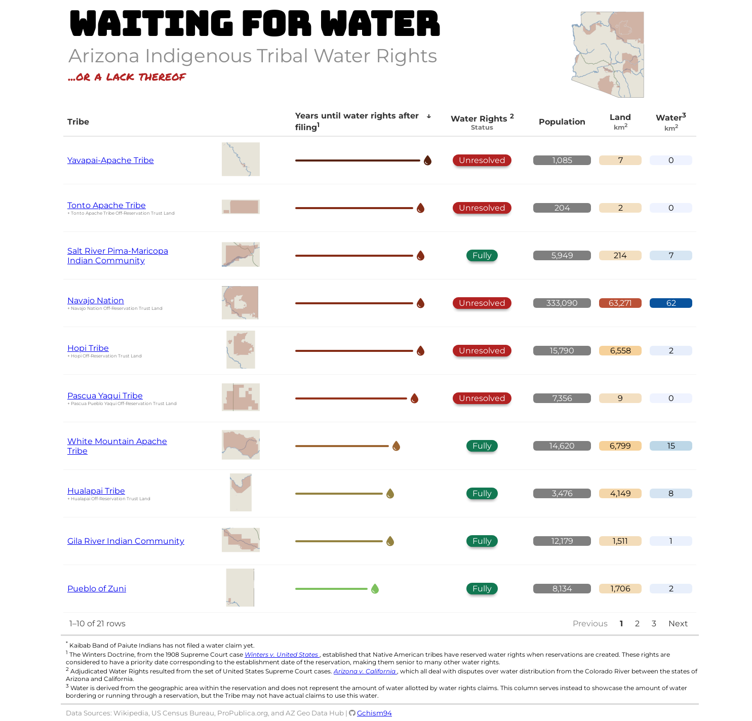
My table submission is an interactive {reactable} table created in R, which describes the current state of Arizona Indigenous Tribal Water Rights. Each US Federally Recognized Tribe in Arizona (22 in total) is represented with a row in the table with information about their land and water areas, population, and water rights status. For each tribe, the table employs CSS styling through {htmltools}, color tiles to display land and water areas using {reactablefmtr}, and an embedded tribal land map with {sf} and {ggplot2}.
Within each tribe's row, additional details include concatenated names of associated regions if there are multiple distinct names. The table also includes a visual representation of the time until water rights were obtained (filing to recognition), using data bars to show years. The water rights status is displayed with color-coded pill buttons, providing a quick visual indicator of the status.
The data includes details on land and water area, population, and the status of water rights claims. The table also incorporates links to additional resources and visualizations, enhancing the understanding of the current state of water rights for Arizona's indigenous tribes.
Edit: Submission type was changed to Single Table Example / Tutorial since it represents both, but it is primarily a Single Table Example. I also fixed some reproducibility issues and added a note for the Water column.
Table Type: interactive-HTML
Submission Type: Single Table Example / Tutorial
Table: Arizona Indigenous Tribal Water Rights
Code: GitHub - Gchism94/posit-table-2024: My submission for the 2024 Posit Table Contest
Language: R
Industries: education.
Packages: reactable, reactablefmtr