Hello,
I'm working on spatial data processing in R and encountered this error:
r
Error
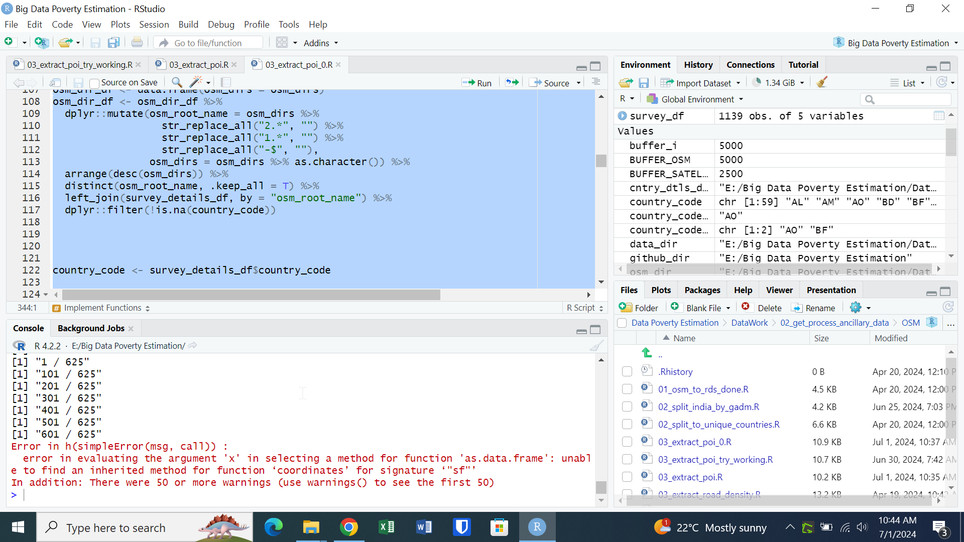
Error in h(simpleError(msg, call)) :
  error in evaluating the argument 'x' in selecting a method for function 'as.data.frame': unable to find an inherited method for function ‘coordinates’ for signature ‘sf’
Here’s the full code:
r
Copy code
# Extract number of POIs and distance to nearest POIs for each survey
# Extract number of POIs and distance to nearest POIs for each survey
# location and type of POI

# Extract number of POIs and distance to nearest POIs for each survey
# location and type of POI
rm(list = ls())


pacman::p_load(tidyverse,
               rgdal,
               viridis,
               readstata13,
               dplyr,
               data.table,
               raster,
               stargazer,
               stringdist,
               tmaptools,
               stringr,
               geosphere,
               rgeos,
               haven,
               ggmap,
               sf,
               sp,
               glmnet,
               rgeos,
               caret,
               mltest,
               RANN,
               lubridate,
               jsonlite,
               httr,
               curl,
               ggpmisc,
               haven,
               sjmisc,
               dbscan,
               ggplot2,
               spatialEco,
               geosphere,
               radiant.data,
               readxl,
               mclust,
               missMDA,
               DescTools,
               furrr,
               countrycode,
               FactoMineR,
               progressr,
               ggmap,
               ggridges,
               ggpubr,
               xgboost,
               WDI,
               scales,
               ggExtra,
               ggrepel,
               ggcorrplot,
               rnaturalearth,
               ggthemes,
               gghalves,
               ggtext,
               ggsignif,
               LiblineaR,
               caret,
               exactextractr)


data_dir <- "E:/Big Data Poverty Estimation/Data"
osm_dir          <- file.path(data_dir, "OSM")
cntry_dtls_dir   <- file.path(data_dir, "Country Details")
# Options:
# -- DHS
# -- DHS_nga_policy_experiment
# -- LSMS
SURVEY_NAME <- "DHS"

github_dir <- "E:/Big Data Poverty Estimation"

source(file.path(github_dir, "Functions", "functions.R"))

source("https://raw.githubusercontent.com/ramarty/download_blackmarble/main/R/download_blackmarble.R")
source("https://raw.githubusercontent.com/ramarty/fast-functions/master/R/functions_in_chunks.R")
source("https://raw.githubusercontent.com/ramarty/rSocialWatcher/52eede6cf561a74584503846eb78ee8bc8fa780b/R/main.R")


REPLACE_IF_EXTRACTED <- TRUE  # or FALSE, depending on your preference
# Parameters -------------------------------------------------------------------
BUFFER_OSM       <- 5000
BUFFER_SATELLITE <- 2500
# Load country_code to OSM dir data --------------------------------------------
# Make dataset that has [country_code] and [osm_root_name] (root name of OSM dir)

## Survey Details
survey_details_df <- read_xlsx(file.path(cntry_dtls_dir, "survey_details.xlsx"))
survey_details_df <- survey_details_df %>%
  dplyr::select(country_code, osm_root_name)


## OSM directories
# If multiple, choose latest
osm_dirs <- list.files(file.path(osm_dir, "FinalData"))

osm_dir_df <- data.frame(osm_dirs = osm_dirs)
osm_dir_df <- osm_dir_df %>%
  dplyr::mutate(osm_root_name = osm_dirs %>%
                  str_replace_all("2.*", "") %>%
                  str_replace_all("1.*", "") %>%
                  str_replace_all("-$", ""),
                osm_dirs = osm_dirs %>% as.character()) %>%
  arrange(desc(osm_dirs)) %>%
  distinct(osm_root_name, .keep_all = T) %>%
  left_join(survey_details_df, by = "osm_root_name") %>%
  dplyr::filter(!is.na(country_code))


country_code <- survey_details_df$country_code

# Define functions -------------------------------------------------------------
load_osm_poi <- function(country_code, osm_dir_df){

  ### A. Define directory
  osm_country_dir <- osm_dir_df$osm_dirs[osm_dir_df$country_code %in% country_code]

  ### B. Load data
  osm1_df <- readRDS(file.path(osm_dir, "FinalData", osm_country_dir, "gis_osm_pois_free_1.Rds"))
  osm2_df <- readRDS(file.path(osm_dir, "FinalData", osm_country_dir, "gis_osm_pois_a_free_1.Rds"))

  ### C. Prep data and spatially define
  osm1_coords_df <- osm1_df %>%
    coordinates() %>%
    as.data.frame() %>%
    dplyr::rename(longitude = 1,
                  latitude = 2) %>%
    bind_cols(osm1_df@data)

  osm2_coords_df <- osm2_df %>%
    coordinates() %>%
    as.data.frame() %>%
    dplyr::rename(longitude = 1,
                  latitude = 2) %>%
    bind_cols(osm2_df@data)

  osm_df <- bind_rows(osm1_coords_df,
                      osm2_coords_df) %>%
    distinct(osm_id, .keep_all = T)

  coordinates(osm_df) <- ~longitude+latitude
  crs(osm_df) <- CRS("+init=epsg:4326")

  osm_df$one <- 1

  return(osm_df)
}

extract_n_poi <- function(buffer_m, country_code, survey_df, osm_dir_df){

  # 1. Prep survey data --------------------------------------------------------
  # Subset and buffer
  survey_df <- survey_df[survey_df$country_code %in% country_code,]

  survey_df <- survey_df %>%
    dplyr::select(uid, latitude, longitude)

  coordinates(survey_df) <- ~longitude+latitude
  crs(survey_df) <- "+init=epsg:4326"

  survey_buff_df <- geo.buffer_chunks(survey_df, r = buffer_m, chunk_size = 100)
  survey_buff_df$one <- 1

  # 2. Load and prep OSM data --------------------------------------------------
  osm_df <- load_osm_poi(country_code, osm_dir_df)

  # 3. N Poi Nearby ------------------------------------------------------------
  for(class_i in unique(osm_df$fclass[!is.na(osm_df$fclass)])){
    print(class_i)

    osm_df_classi <- osm_df[osm_df$fclass %in% class_i,]

    class_df <- over(osm_df_classi, survey_buff_df)$uid %>%
      as.character() %>%
      as.data.frame() %>%
      dplyr::rename(uid = ".") %>%
      dplyr::filter(!is.na(uid)) %>%
      group_by(uid) %>%
      dplyr::summarise(N = n()) %>%
      ungroup()

    names(class_df)[names(class_df) %in% "N"] <- paste0("osm_n_poi_", class_i)

    survey_df <- merge(survey_df, class_df, by = "uid", all.x=T)
    survey_df@data[paste0("osm_n_poi_", class_i)][is.na(survey_df@data[paste0("osm_n_poi_", class_i)])] <- 0
  }

  # 4. Cleanup -----------------------------------------------------------------
  survey_df <- survey_df@data

  survey_df <- survey_df %>%
    dplyr::rename_at(vars(-uid), ~ paste0(., "_",buffer_m,"m_buff"))

  return(survey_df)
}

extract_dist_poi <- function(country_code, survey_df, osm_dir_df){

  # 1. Prep survey data --------------------------------------------------------
  # Subset and buffer
  survey_df <- survey_df[survey_df$country_code %in% country_code,]

  survey_df <- survey_df %>%
    dplyr::select(uid, latitude, longitude)

  coordinates(survey_df) <- ~longitude+latitude
  crs(survey_df) <- "+init=epsg:4326"

  survey_sf <- survey_df %>% st_as_sf()

  # 2. Load and prep OSM data --------------------------------------------------
  osm_df <- load_osm_poi(country_code, osm_dir_df)

  # 3. Distance to Class --------------------------------------------------------
  for(class_i in unique(osm_df$fclass[!is.na(osm_df$fclass)])){

    osm_df_classi <- osm_df[osm_df$fclass %in% class_i,]

    print(paste0(class_i, " - ", nrow(osm_df_classi)))

    ## Grab one observation; replace geometry in next step
    osm_df_classi_agg <- osm_df_classi[1,] %>% st_as_sf()

    osm_df_classi_combine <- osm_df_classi %>%
      st_as_sf() %>%
      st_combine()

    osm_df_classi_agg$geometry <- st_geometry(osm_df_classi_combine)

    #osm_df_classi_agg <- osm_df_classi %>%
    #  gBuffer_chunks(width = 0.0001, chunk_size = 2000) %>%
    #  raster::aggregate(by = "one") %>%
    #  st_as_sf()


    if(nrow(osm_df_classi) <= 50000){
      buffer_chunk_n <- 3000
    } else{
      buffer_chunk_n <- 1000
    }

    survey_df[[paste0("osm_distmeters_poi_", class_i)]] <- st_distance_chunks(survey_sf, osm_df_classi_agg, buffer_chunk_n)
  }

  return(survey_df@data)
}

# Load survey data -------------------------------------------------------------
survey_df <- readRDS(file.path(data_dir, SURVEY_NAME, "FinalData", "Individual Datasets",
                               "survey_socioeconomic.Rds"))

if(SURVEY_NAME %in% "DHS"){
  survey_df <- survey_df %>%
    dplyr::filter(most_recent_survey %in% T)
}

survey_df <- survey_df %>%
  dplyr::select(uid, country_code, year, latitude, longitude) %>%
  dplyr::filter(!is.na(latitude))

if(SURVEY_NAME %in% "OPM"){
  survey_df <- survey_df %>%
    distinct(uid, .keep_all = T)
}

country_codes_all <- survey_df$country_code %>% unique()
#country_codes_all <- country_codes_all[country_codes_all != "GY"]

# Load country_code to OSM dir data --------------------------------------------
# Make dataset that has [country_code] and [osm_root_name] (root name of OSM dir)

## Survey Details
survey_details_df <- read_xlsx(file.path(cntry_dtls_dir, "survey_details.xlsx"))
survey_details_df <- survey_details_df %>%
  dplyr::select(country_code, osm_root_name)

## OSM directories
# If multiple, choose latest
osm_dirs <- list.files(file.path(osm_dir, "FinalData"))

osm_dir_df <- data.frame(osm_dirs = osm_dirs)
osm_dir_df <- osm_dir_df %>%
  dplyr::mutate(osm_root_name = osm_dirs %>%
                  str_replace_all("2.*", "") %>%
                  str_replace_all("1.*", "") %>%
                  str_replace_all("-$", ""),
                osm_dirs = osm_dirs %>% as.character()) %>%
  arrange(desc(osm_dirs)) %>%
  distinct(osm_root_name, .keep_all = T) %>%
  left_join(survey_details_df, by = "osm_root_name") %>%
  dplyr::filter(!is.na(country_code))

# Implement Functions ----------------------------------------------------------
#### N POI
for(buffer_i in BUFFER_OSM){
  for(country_code_i in country_codes_all){
    print(paste0("N POI: ", country_code_i, " - ", buffer_i, " =============="))

    OUT_PATH <- file.path(data_dir, SURVEY_NAME,
                          "FinalData", "Individual Datasets", "osm", "poi",
                          paste0("osm_",country_code_i,"_n_poi_",buffer_i,"m_buff.Rds"))

    if(!file.exists(OUT_PATH) | REPLACE_IF_EXTRACTED){
      survey_df_i <- extract_n_poi(buffer_i, country_code_i, survey_df, osm_dir_df)
      saveRDS(survey_df_i, OUT_PATH)
    }
  }
}

buffer_m = buffer_i
country_code = country_code_i
survey_df = survey_df
osm_dir_df = osm_dir_df

#### Dist POI
for(country_code_i in country_codes_all){
  print(paste0("DIST POI: ", country_code_i, " =============================="))

  OUT_PATH <- file.path(data_dir, SURVEY_NAME,
                        "FinalData", "Individual Datasets", "osm", "poi",
                        paste0("osm_",country_code_i,"_dist_poi_buff.Rds"))

  if(!file.exists(OUT_PATH) | REPLACE_IF_EXTRACTED){
    survey_df_i <- extract_dist_poi(country_code_i, survey_df, osm_dir_df)
    saveRDS(survey_df_i, OUT_PATH)
  }
}
Screen shot of the error please
Any insights on resolving this error would be greatly appreciated!
Thanks